• Skip to primary navigation
  • Skip to main content
Center for Natural Resource Information and Technology

Center for Natural Resource Information and Technology

Decision support through data and computer modeling

  • Home
  • About CNRIT
  • GAN Lab: Grazingland Animal Nutrition Lab
    • GANLAB services
  • Decision Support Systems
    • NIRS: Near infrared reflectance spectroscopy
    • NUTBAL: Livestock nutrition balance decision support system
    • FRAMS: Forage risk assessment management system
    • BRASS: Burning risk assessment support system
    • LMIS: Livestock marketing information system
    • PestMan: Brush and weed management decisions for Texas and New Mexico
    • PHYGROW: Phyto mass growth model
  • Projects
    • USDA Forest Service BRASS: Burning Risk Advisory Support System
    • Mali Livestock and Pastoralist Initiative
    • Mongolia LEWS: Livestock Early Warning System
    • East Africa LEWS: Livestock Early Warning System
  • Publications
  • Careers
  • Show Search
Hide Search

gabe.saldana

NIRS: Near infrared reflectance spectroscopy

gabe.saldana · May 5, 2022 ·

NIRS: Near-infrared reflectance spectroscopy

Technology for rapidly assessing diet nutritional value of free-ranging livestock.

What is NIRS?

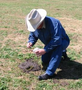
Near-infrared reflectance spectroscopy (NIRS) is the technology that the GAN LAB uses to analyze animal fecal samples.

The NIRS process involves exposing a dried, ground fecal sample to light energy. The intensity of reflectance is measured across several hundred wavelengths in the near-infrared band. Reflectance is influenced by the number and type of chemical bonds in the feces. Primary wavelengths in prediction equations appear to be associated with the fiber, alkane and microbial fractions of the feces.

Adviancing research with NIRS

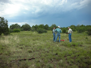
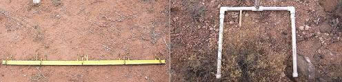
A team of scientists with Texas A&M AgriLife began researching NIRS technology in the early 1990s. They succeeded at predicting dietary crude protein and digestible organic matter, DOM, of cattle (Lyons and Stuth 1992) and later with small ruminant Spanish goats (Leite and Stuth 1995) via fecal profiling. This research was conducted in collaboration with experiment stations at various sites in mid-South Texas, Central Texas, Central Oklahoma, and Central Missouri. Laboratory values were regressed against matched fecal spectra using a Perstorp Scientific 6500 machine equipped with ISI software. Known diet samples were matched with feces of intact cows grazing a wide variety of forages. These diet – fecal pairs were used to develop a reference data set to build prediction or calibration equations. Fecal equation diet quality predictions were then validated against herds with known diet qualities. Equations developed to date have been evaluated in a wide variety of forage types. Currently, the lab can predict dietary crude protein (CP%) and digestible organic matter (DOM%) as well as fecal nitrogen (FN%) and fecal phosphorus (FP%).

Expanding NIRS with cloud computing

Since the initial NIRS studies concluded, over 30 research projects have been conducted using NIRS technology to analyze the diet quality of cattle, deer, elk, bison, and giant pandas among others. In 1995, the original nutritional balance software, or NUTBAL app, was created to help create a least-cost nutritional management plan by using results from NIRS fecal profiling. NUTBAL through the years has been augmented with further research and is now an online “cloud computing” application designed to provide site-specific nutrition recommendations.

Client decision support through the NIRS/NUTBAL system

NIRS results provide forage quality data needed by the NUTBAL decision support software.  This software combines the NIRS results with information about animal descriptions (kind, class, breed), body condition, forage conditions, supplemental feed information, environmental conditions and performance targets. Scientists of the GANLAB use this “NIRS/NUTBAL system” to produce nutritional balance reports for protein and net energy and a report for least-cost feeding solutions.  If a deficiency exists, NUTBAL can determine the amount of least-cost feedstuff needed to correct the problem.

These reports can be used by producers, by GANLAB staff, by trained consultants, or in some cases, by extension personnel to provide advisory reports to clients. Customers of the GANLAB may purchase a NUTBAL Advisory in addition to the NIRS/NUTBAL System Report. This Advisory is an interpretation of the results and recommendations for nutritional management.

Fecal sample submission and services
Learn more about the GANLAB
Learn more about NUTBAL

NUTBAL: Livestock nutrition balance decision support system

gabe.saldana · April 25, 2022 ·

NUTBAL: Livestock nutrition balance decision support system

A decision support system that monitors animal diet nutrient concentrations for diet optimization toward producer goals

Animal nutrition-based decision making

NUTBAL’s primary purpose is to provide the livestock industry with the means to monitor the nutrient concentration in the animal’s diet and determine if the current diet is sufficient to meet performance goals set by the producer. NUTBAL is a decision support system that models the crude protein and net energy status of cattle, sheep, and goats.  This computerized decision aid lets the user their herd, environmental conditions, and establish weight performance targets. This information is then coupled with results from a near-infrared reflectance spectroscopy, or NIRS fecal analysis, by scientists at the Grazingland Animal Nutrition Lab, GANLAB. From this, the lab produces an animal performance report and the least-cost nutrition management plan.

NIRS/NUTBAL Reports include the following information:

  • plane of nutrition
  • weight gain or loss
  • the nutrient most limiting animal performance
  • least cost feeding solution
  • amount of feed and forage consumed
Go To NUTBAL Online
Fecal sample submission and services
Learn more about the GANLAB
Learn more about NIRS

Unlike many nutritional balance packages geared toward pen-fed animals, NUTBAL calculates what animals will consume ad libitum under grazing conditions. In many cases, voluntary intake of ruminants in free-ranging conditions differs from that predicted by published equations.

Applications

As part of the NIRS/NUTBAL system, NUTBAL is an effective nutritional monitoring tool designed for ranchers and other free-grazing managers.  The system generates valuable information that enables the user to make informed and timely decisions regarding animal nutrition and grazing management. Private enterprise applications of the NIRS/NUTBAL system are varied and can be custom designed to meet the goals of the individual user.  Most private users employ NUTBAL to assist in one or a combination of:

  • Monitoring a reproductive herd’s nutrition year-round winter feed management.
  • Monitoring nutrition of grazing stockers.

Developing and managing replacement breeding stock with grazing protocols that correspond to the goals of NUTBAL users might include:

  • Improving body condition more economically
  • Managing weight loss during drought or dormant forage periods
  • Maintaining desired body condition during critical periods to enhance productivity
  • Enhancing effectiveness of supplement feeding by identifying when forage is inadequate, when forage quality recovers and how much feed is needed to meet goals
  • Meeting weight gain goals
  • Others

Various agencies and groups also use the NIRS/NUTBAL system as a research tool in developing guidelines for the public, collecting data, and facilitating environmental conservation, to name a few.  Such programs include EQIP, CSP, and the Forage Quality & Animal Well-being Program.

Availability

Farmer taking manure sample

Access to NUTBAL is available via the interactive website, NUTBAL online. The online application allows users to submit their information for NIRS analysis on a livestock fecal sample which is then mailed to the GANLAB.  Once the GANLAB completes and records the sample’s NIR analysis, the interactive website automatically generates NUTBAL reports for the sample based on data entered by a user. The NUTBAL software is available in a metric unit of measure version as well as the English unit version.

Go to NUTBAL Online
Fecal sample submission and services

Model Systems

The NUTBAL model uses a combination of published systems including the NRC’s 1984, 1987, 1996 basic nutrient requirements formulas, Fox et al. (1988) adjustments to the NRC equations, McCollum’s rumen degradable protein thresholds and DOM/CP ratio concepts and Moore and Kunkel’s concept of intake change rate and deviation of metabolizable energy due to associative effects in growing animals.  Where NUTBAL deviates from other systems is in the application of a quasi-metabolic fill system to predict dry matter intake of the animal. This approach allows modeling of fecal output processes, which consider more than just the digestion process. Other factors are derived from literature review, expert opinion and unpublished data extrapolated from prior studies.  Impacts of forage availability, appetite drive, and associative effects can be characterized in both fecal output as a proportion of fat-corrected body weight and metabolizability of ingested forage.

Go to NUTBAL Online

CNRIT Projects

NUTBAL and the NIRS/NUTBAL monitoring system are an important part of several CNRIT projects that include, East Africa LEWS, FRAMS, Mali Livestock, and Pastoralist Initiative, and Mongolia LEWS. While US-based projects tend to focus towards conservation or efficiency issues, international projects benefit from the ability to evaluate and project changes in animal well-being which can be closely followed by changes in the people’s well-being in a region.

Browse CNRIT Projects

FRAMS: Forage Risk Assessment Management System

gabe.saldana · April 25, 2022 ·

FRAMS: Forage Risk Assessment Management System

A dynamic, 24/7, web-based forage risk assessment and management system for the ranching industry

Addressing the threat of drought

Drought represents one of the greatest risks facing ranchers, unlike other livestock industries such as poultry and pork. Because of long-term investment in breeding stocks, unfavorable market prices or demands for land payments, ranchers face tough choices when confronted with decisions to retain livestock and feed, partially destock and feed or sell animals. Currently, the ranching industry has been underserved given the limited tools and techniques made available to the industry to cope with a fluctuation in weather and market conditions. Livestock producers desire ways to explore trade-offs of rotating, selling, replacing or buying animals in response to forage, animal, and market conditions.

sunset on desert landscape wide shot

Objective

Forage Risk Assessment Management System (FRAMS) is a dynamic risk management decision tool currently in the BETA test phase of development. Its objective is to offer the ranching industry a web-based risk management tool for a forage risk assessment and management system that is available 24/7. The system provides the means to monitor and assess the performance of free-grazing animals, the forage conditions in response to site-specific weather, and the potential least-cost feeding or destocking decisions relative to market and weather risk.

Summary

Forage Risk Assessment Management System (FRAMS) is a dynamic risk management decision tool currently in the BETA test phase of development. Its objective is to offer the ranching industry a web-based risk management tool for a forage risk assessment and management system that is available 24/7. The system provides the means to monitor and assess the performance of free-grazing animals, the forage conditions in response to site-specific weather, and the potential least-cost feeding or destocking decisions relative to market and weather risk.

FRAMS is supported by several automated monitoring procedures. NOAA weather data needed for forage modeling and animal nutrient requirement models are utilized within the system. To assess livestock nutritional status and performance, ranchers would collect fecal samples, enter the animal-related information online and mail them by 2-day priority mail to the Grazingland Animal Nutrition lab (GANLAB) at Texas A&M University for analysis. Forage quality will be determined by NIRS analysis of the fecal sample. The Nutritional Balance Analyzer software (NUTBAL) will use crude protein and digestible organic matter estimates (based on the NIRS scans) to predict animal performance. NUTBAL reports will be provided online to the rancher. FRAMS will also allow ranchers to establish geo-referenced rain gauges online and assign a pre-parameterized reference plant community to them. Each site will be automatically linked to the NOAA 12×12 or 4×4 mile weather grid system where the recorded rainfall input by the rancher is integrated with the solar radiation and temperature data to drive a site-specific forage growth simulation model (PHYGROW) that computes forage deviation from normal and percentile ranking.

 Rancher Benefits

Ranchers participating in the FRAMS project will have almost immediate access to the FRAMS system and be able to monitor the status of their ranch after forage surveys of ranch sites are completed and PHYGROW is parameterized for the ranch. Ranchers will enjoy the benefits of using both the NIRS/NUTBAL services and the FRAMS system at no charge (not including postage for mailing in fecal samples). Use of the NIRS/NUTBAL services alone can be valued at approximately $600+ per year. Employing services from other sources that offer similar outputs or results would be several times that amount.

Members of the ALPHA test team found participating in the development of FRAMS to be educational and a benefit to their operation.

History

The first 2-phase, 3-year pilot study for FRAMS has been completed. The first RMA funded study included a group of ranchers (ALPHA testers) in four states representing a diverse set of environmental and production decision environments covering parts of New Mexico, Texas, West Virginia, and Wyoming. Funding for the expansion of FRAMS brought in ranchers from Oklahoma and Louisiana as well as additional ranchers in the original 4 states in 2007 and 2008. Members of the FRAMS design team include ranchers, Texas AgriLife Research’s Ranching Systems Group, extension agents, Natural Resource Conservation Service (NRCS) grazingland conservationists, USDA Risk Management Agency specialists, Grazingland Animal Systems, Inc. and AgriLogic, Inc., to help design and test the system.

Contact Information

For more information, contact Jay Angerer at the Center for Natural Resource Information Technology (CNRIT) at Texas AgriLife Research.

USDA Forest Service BRASS: Burning Risk Advisory Support System

gabe.saldana · April 25, 2022 ·

USDA Forest Service BRASS: Burning Risk Advisory Support System

Developing the USDA Forest Service’s vegetation and fire monitoring system

Protecting National Forests and Grasslands from fire

Researchers taking samples in an open field
Researchers take samples in a national grassland

The U.S. Department of Agriculture Forest Service is a Federal agency that manages public lands in national forests and grasslands. Administering 193 million acres of land, an area equivalent to the size of Texas, the US Forest Service is divided into 9 regions, encompassing 155 National Forests and 20 National Grasslands. The natural resources on these lands are some of the Nation’s greatest assets and have major economic, environmental, and social significance for all Americans.

The mission of the USDA Forest Service is to sustain the health, diversity, and productivity of the Nation’s forests and grasslands to meet the needs of present and future generations.

Role of BRASS: Burning Risk Advisory Support System

In keeping with US Forest Service guiding principles of using an ecological approach to multiple-use management, using the best scientific knowledge in making decisions, and selecting the most appropriate technologies in the management of resources, the BRASS (Burning Risk Advisory Support System) decision support tool provides a continuous means for forest and grassland managers to assess vegetation and weather to support decisions related to prescribed burning and/or the risk of wildfire.

The objective of the vegetation and fire monitoring system is to inventory, monitor, evaluate, and integrate land condition trends and capabilities with Forest Service management and public use goals to enhance, improve, repair, and sustain national forests and grasslands. Texas Agrilife Research has a continuing agreement with the US Forest Service to develop this system using a viable Phytomass Plant Growth model (PHYGROW) and a Burning Risk Advisory Support System (BRASS).

History

Texas A&M Agrilife Research began its involvement with the US Forest Service in 2005 with a contract through the USDA Risk Management Agency (RMA) to develop BRASS for the Lincoln National Forest in New Mexico. An extension was received which also included the Prescott National Forest, and later in 2008, the Coconino National Forest in Arizona.

We are currently working on developing the BRASS model for other forests including the Kaibab, Carson, and Santa Fe, as well as creating a new scalable technology stack of the automation system that we can transfer to the Forest Service so that they can model their forests independent of CNRIT.  Though our models and GIS applications will remain in C and C++, our handlers, web services, and other middleware applications are all being converted to PHP 5 and javascript for easy to maintain open source functionality.

Data Collection

Field collected vegetation data is necessary to parameterize and validate the PHYGROW growth model.  The PHYGROW sample points have been distributed across the landscape based on unique plant communities. The plant communities were established using a combination of unique spectral characteristics of the vegetation obtained from satellite imagery, unique ecological sites, and major land use areas of the forests.  For the initial field data collection at each sample point, the species composition, litter production, and herbaceous production parameters are determined along a permanent transect.

measuring tools on dirt floor
A 1-meter PHYGROW sampling frame (left) contains four equidistant points for measuring basal areas of perennial grasses and cover classes, with 5x5cm quadrants for frecuency of herbaceous vegetation. A 40x40cm frame (right) containes three sampling points at the top center endpoints, with 10 cm and 40cm frequency quadrants

Field sampling on the Lincoln and Prescott National forests followed the standard PHYGROW sampling procedure.  In 2008, a method was developed on the Coconino National Forest integrating the Quadrat Frequency Method (QFM), an existing Forest Service sampling technique, with the PHYGROW sampling method.  The resulting Enhanced quadrat Frequency Method (EFM) can be used by Forest Service personnel to collect data necessary for Forest Service purposes, while still collecting all data needed for the PHYGROW model. Pictured below are the PHYGROW sampling frame (left) and the EFM sampling frame (above left).

Landscape Modeling

The BRASS decision support tool provides a continuous means for the US Forest Service resource managers to assess vegetation and weather to support decisions related to prescribed burning and/or the risk of wildfire. The BRASS system is composed of two main components, the PHYGROW growth model and the PHYRESIM burning model.  PHYRESIM was developed from a software toolkit called Firelib, which is the same toolkit that drives the highly respected BEHAVE burning application.  Firelib was developed by the US Forest Service as a toolkit to build custom BEHAVE type applications.

elevation map
A didgital elevation model is a type of imagery used to enhance fire modeling capabilities. It is used to monitor watersheda and to calculate slope, aspect and elevation — factors that affect a fire’s direction and spread rate.

The PHYGROW model is a near-real-time plant growth model that is updated daily utilizing current and forecasted weather conditions from the National Oceanic and Atmospheric Administration (NOAA).  A PHYGROW model has been calibrated for each of the major plant communities and ecological sites within the base, which will continuously monitor vegetation production and fuel load conditions.

In order to distribute the modeled point data across the landscape, a methodology developed by the US Forest Service has been implemented called Most Similar Neighbor (MSN).  First, a landscape map of plant communities is developed within a Geographic Information System (GIS) using available resources such as ecological site maps derived by the Natural Resource Conservation Service (NRCS), plant communities derived from classification of remotely sensed satellite imagery, and supplemental field collected data.  Advanced image processing software (i.e. ERDAS, ENVI, and IDRISI) has facilitated the development of plant community polygons from multispectral satellite imagery.  Next, the necessary PHYGROW and BRASS field sample data is collected for a minimum of one polygon within each unique plant community.  The field-collected dataset is then distributed across the landscape by matching similar non-sampled plant community polygons as determined by the MSN analysis with field sample data collected within the sampled polygons.

The PHYGROW output is integrated with the fire behavior model, PHYRESIM, to provide a continuously updated fire risk map for an area. PHYGROW outputs current live herbaceous moisture, live herbaceous production, 1-hr. fuel accumulation, live wood moisture, and live wood production to the PHYRESIM subsystem on a daily basis.  PHYRESIM coordinates the fuel moisture stick model and PHYGROW outputs with NOAA current and forecasted weather data to produce a 7-day forecast updated at 6-hour intervals. Changing weather conditions and fluctuating plant communities create dynamic BRASS 30-minute burn area, flame length, spread rate, and fuel moisture outputs.  This data can be used to select areas beforehand with adequate fuel-load and appropriate weather conditions for a prescribed burn, as well as, determine wildfire risk conditions.

Product Delivery

The final delivery for these multi-forest projects is the BRASS (Burning Risk Advisory Support System) software and configuration database. Fire conditions can be assessed for any point on a forest via the internet to assist controlled burn crews, firefighters, and other groups associated with fire management in assessing conditions in the field.  Additional range information such as vegetation production, drought prediction, and historical ranking is also delivered through the internet.  The US Forest Service will establish it’s own data center for running the BRASS software and will begin using their own system by the end of 2012.

Publications

Rhodes, E.C., D. Tolleson, W. Shaw, E. Twombly, J. Kava, and T. Brown. 2009. Comparing herbaceous vegetation sampling methods on the Coconino National Forest, AZ, USA. Society for Range Management 62nd Annual Meeting, Albuquerque, NM.

Mali Livestock and Pastoralist Initiative

gabe.saldana · April 25, 2022 ·

Mali Livestock and Pastoralist Initiative

Access to technology, capacity building for a stronger livestock system in Mali

Mali livestock and pastoralist initiative logo

A mission to improve the Mali livestock system

USAID-Mali has identified an overall goal to “improve the productivity and income of the producers in Mali by enabling them to access technologies and build the capacity of all actors involved in the development of an extensive livestock system”.  To meet this goal, USAID-Mali has outlined these specific objectives:

  1. Promote the development of the extensive livestock sector,
  2. Empower pastoralists and improve their capacity for risk management,
  3. Create equitable livestock information and communication systems that provide monitoring and analysis technology to foster strategic partnerships between pastoral communities, markets, and policy,
  4. Markets development and integration,
  5. Build capacity of Mali to sustain the new techniques and technologies.

To meet this overall goal and the specific objectives, the Mali Livestock and Pastoralist Initiative project was initiated in 2008.  The project is led by Texas AgriLife Research with US partners that include Syracuse University, University of Arizona, University of Wisconsin, and South Dakota State University.  Government and educational partner organizations in Mali include Observatoire du Marche Agricole (OMA), Direction Nationale des Productions et des Industries Animales (DNPIA), Institut d’Economie Rurale (IER), and l’Institut Polytechnique Rural (IPR).

  • Go to page 1
  • Go to page 2
  • Go to page 3
  • Go to Next Page »

A member of
Texas A&M AgriLife

Texas A&M AgriLife Extension Service | Texas A&M AgriLife Research | Texas A&M Forest Service | Texas A&M AgriLife Veterinary Medical Diagnostic Lab | College of Agriculture & Life Sciences

Center for Natural Resource Information and Technology

Compact with Texans | Privacy and Security | Accessibility Policy | State Link Policy | Statewide Search | Veterans Benefits | Military Families | Risk, Fraud & Misconduct Hotline | Texas Homeland Security | Texas Veteran's Portal | Equal Opportunity | Open Records/Public Information